Machine Learning and artificial Intelligence
Machine Learning and artificial Intelligence in GIS
Machine learning has been a core component of spatial analysis in GIS. These tools and algorithms have been applied to geoprocessing tools to solve problems in three broad categories.Classication: Classification allows you can use support vector machine algorithms to create land cover classification layers.
Clustering: Clustering lets you process large quantities of input point data, identify the meaningful clusters within them, and separate them from the sparse noise.
Prediction: Prediction algorithms such as geographically weighted regression allows you to use geography to calibrate the factors that help you predict. These methods work well in several areas and their results are interpretable, but they need experts to identify or feed in those factors (or features) that affect the outcome that we’re trying to predict.
Applying Computer Vision to geospatial analysis
One area of AI where deep learning has done exceedingly well is computer vision, or the ability for computers to see. This is particularly useful for GIS, as satellite, aerial and drone imagery is being produced at a rate that makes it impossible to analyse and derive insight from through traditional means. The figure below shows some of the most important computer vision tasks or use cases and how they can be applied to GIS: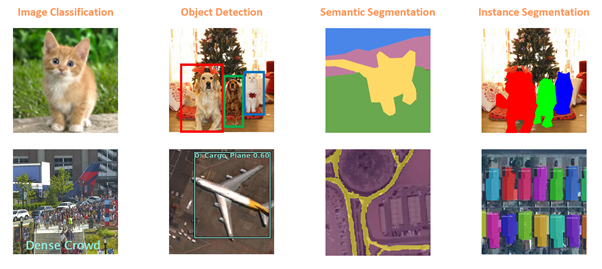
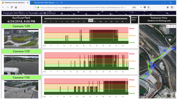
The simplest is Image Classification, in which the computer assigns a label, such as ‘cat’ or ‘dog’ to an image. This can be used in GIS to categorize geotagged photos. In the example above, we have an image that’s been classified as having a ‘dense crowd’ and such pedestrian activity classification can be used for pedestrian and traffic management planning during public events.
Next, we have Object Detection in which the computer needs to find objects within an image as well as their location . This is a very important task in GIS — finding what is in satellite, aerial or drone imagery, and where, and plotting it on a map can be used for infrastructure mapping, anomaly detection and feature extraction.
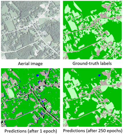
Another important task in computer vision is Semantic Segmentation — in which we classify each pixel of an image as belonging to a particular class. For instance, in the image in Fig 1, the cat is in the yellow pixels, and the green pixels belong to the ground class and the sky is in blue. In GIS, semantic segmentation can be used for Land Cover Classification or to extract road networks from satellite imagery.
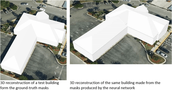
Another type of segmentation is Instance Segmentation, that you can think of as a more precise object detection in which the precise boundary of each object instance is marked out. This can be used for tasks like improving basemaps by adding building footprints or reconstructing 3D buildings from LiDAR data.
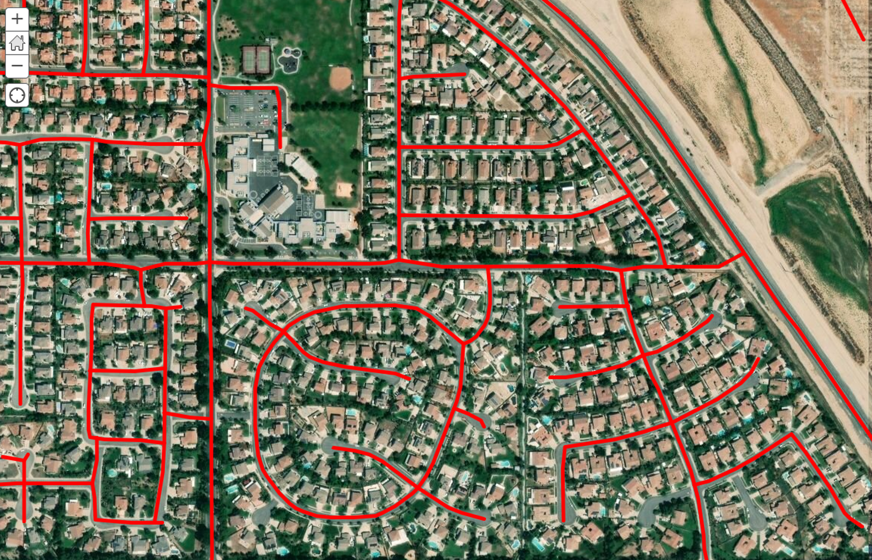
An important application of deep learning for satellite imagery is to create digital maps by automatically extracting road networks and building footprints. Imagine applying a trained deep learning model on a large geographic area and arriving at a map containing all the roads in the region, as well as the ability to create driving directions using this detected road network. This can be particularly useful for developing countries that do not have high quality digital maps or in areas where newer development have taken place.
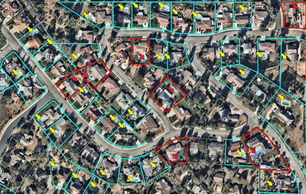
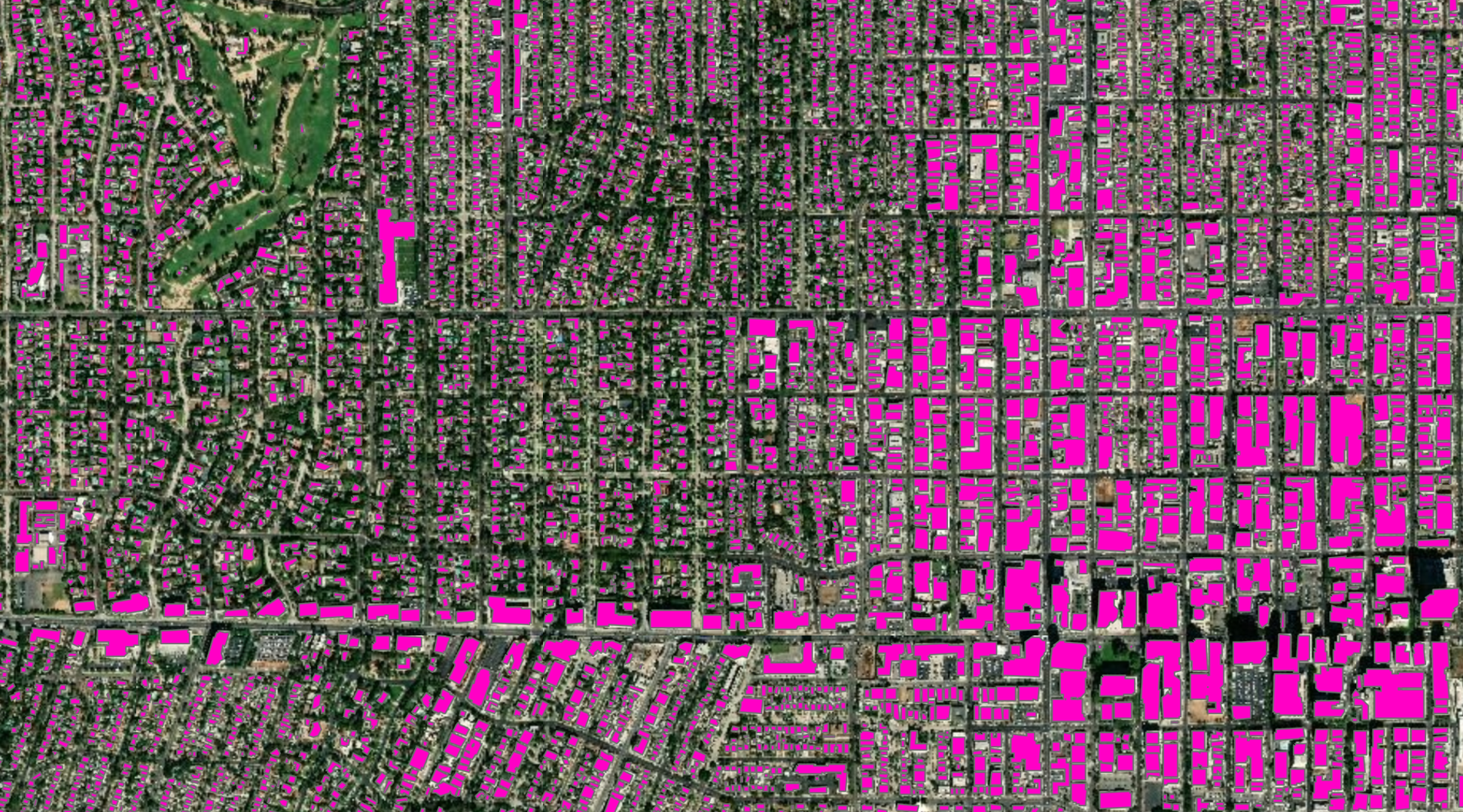
Good maps need more than just roads though — they need buildings. Recent developments of instance segmentation models like Mask-RCNN are particularly useful for building footprint segmentation, and can help create building footprints without any need of manual digitizing.
Our Speciality
Object extraction by applying AI and Machine learning to satellite imagery.Grouping the data using spatial and non spatial claissification and clustering.
Prediction using spatial and non spatial data.