GIS data services
GIS Data Services
GIS (Geographic Information System) data services refer to the collection, management, analysis, and dissemination of geographic data through various means. These services involve the utilization of GIS technology to work with spatially referenced data, which includes information tied to specific geographic locations.
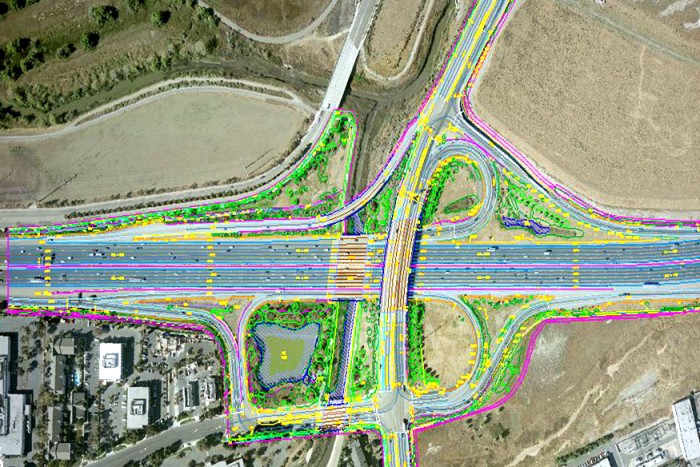
Photogrammetry
Photogrammetry is a technique used to create accurate 3D models or measurements of objects and environments by analyzing photographs taken from different angles. It involves extracting spatial information from photographs to reconstruct the shape, size, and position of objects or landscapes.
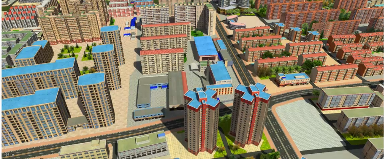
3D Modelling
3D modeling is the process of creating a digital representation of a three-dimensional object or environment using specialized software. It involves building a virtual 3D model that can be viewed, manipulated, and rendered from various angles. 3D models are widely used in industries such as animation, video games, film production, architecture, product design, and virtual reality.
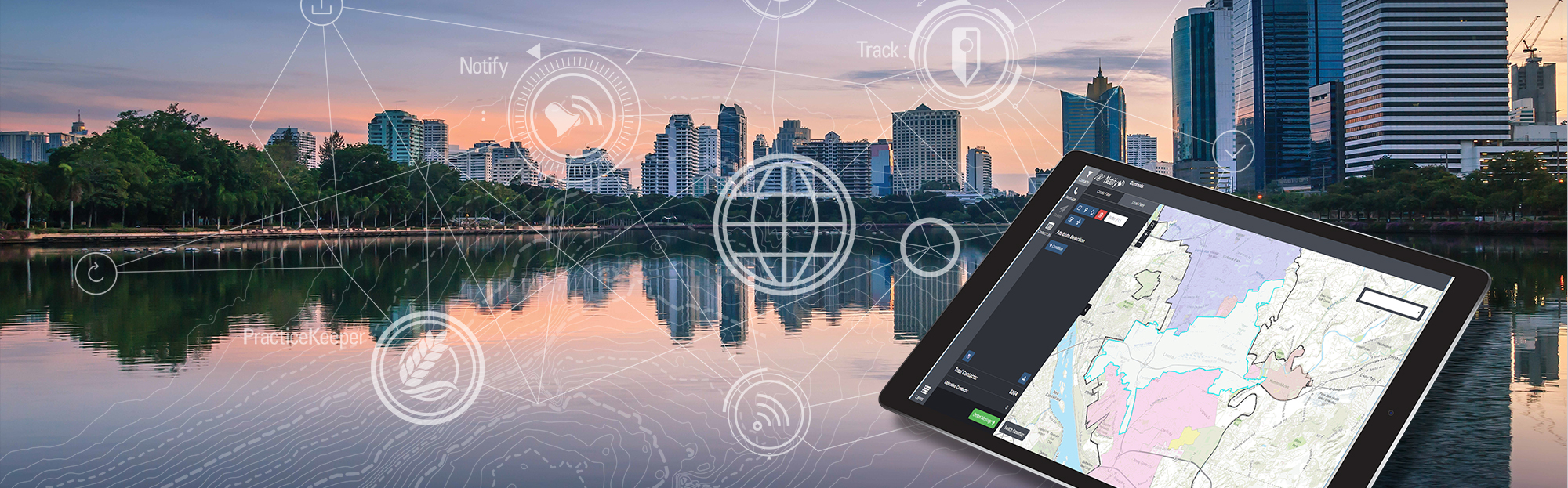
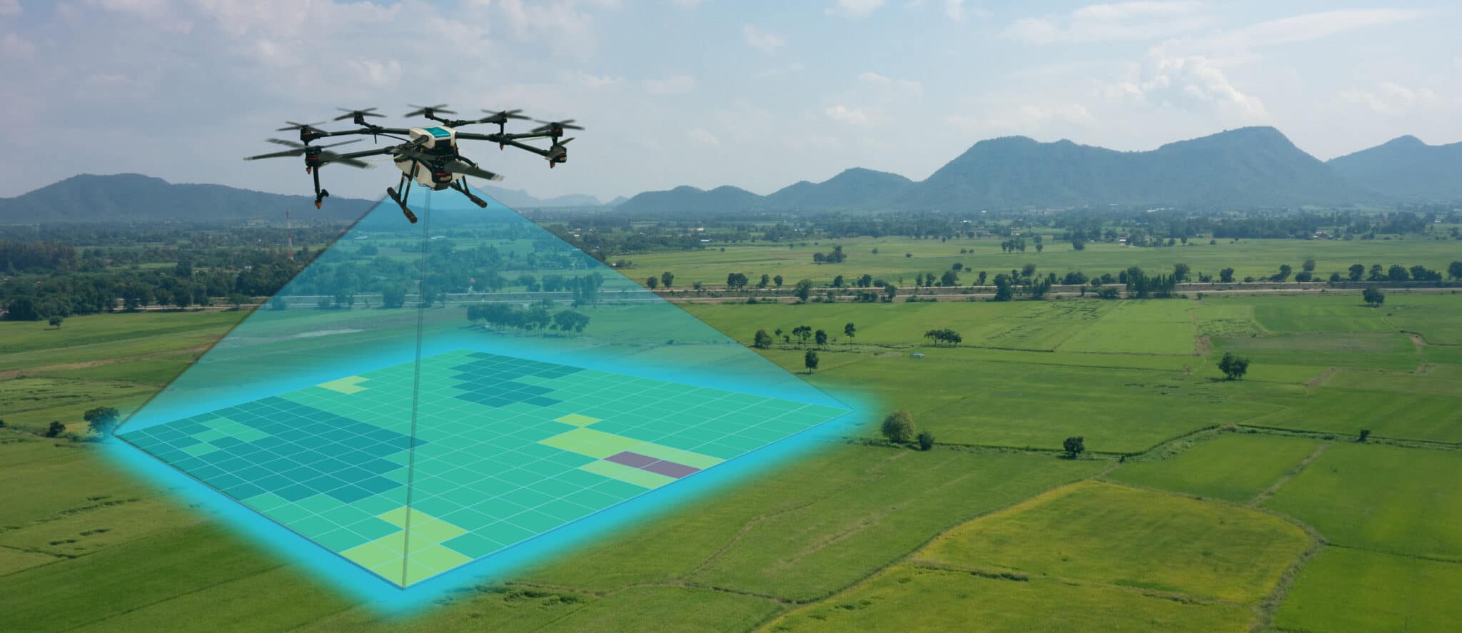
GIS
GIS (Geographic Information System) is a system designed to capture, store, analyze, manage, and present spatial or geographic data. It combines hardware, software, data, and people to facilitate the collection, interpretation, and visualization of geospatial information.
LiDAR Services
LiDAR (Light Detection and Ranging) services involve the collection, processing, and analysis of geospatial data using LiDAR technology. LiDAR is a remote sensing technique that uses laser pulses to measure distances and create detailed 3D representations of objects and surfaces.
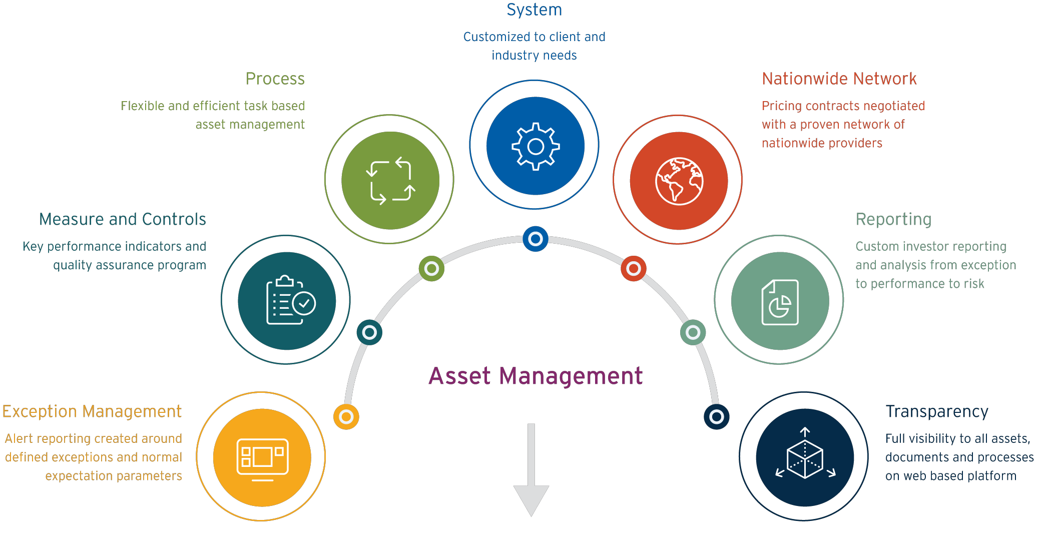
Asset Management
Asset management refers to the systematic and strategic approach of managing an organization's assets throughout their lifecycle to optimize their performance, value, and utilization. Assets can include physical assets (such as buildings, equipment, infrastructure), financial assets, intellectual property, and other tangible or intangible resources.