Solar Plant Survey
Solar Energy
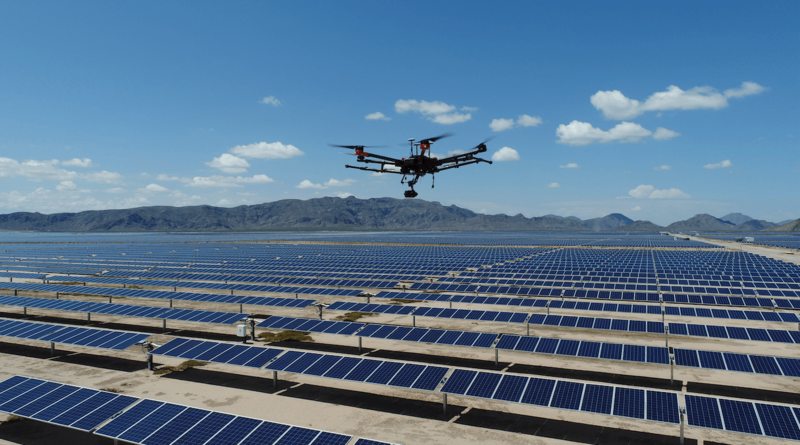
Drones are transforming solar PV plant surveys by providing quicker, safer, and cost-effective inspections. With advanced sensors and cameras, drones capture high-resolution data for accurate analysis. They can access hard-to-reach areas and cover large areas in a short time, reducing inspection duration and costs. By identifying defects early on, drones help optimize plant efficiency and ensure uninterrupted energy production.
Brief
Our aerial thermal imaging survey for solar farms accurately detects and locates faulty cells, debris, string errors, damaged diodes, and PID faults on solar panels. Equipped with high-quality thermal imaging cameras, we can efficiently identify abnormal temperature patterns and optimize energy production. By precisely pinpointing the location of cell faults, either through GPS referencing or graphical overlays, we can effectively address issues and maximize the performance of the solar installation.
We Provide
Our drone-based inspections utilize advanced image processing algorithms and thermal sensors to identify abnormalities such as hot-spots, vegetation encroachment, and dust covers in solar installations. This technology provides precise details on the module number, position, and temperature of the identified issues. By leveraging these capabilities, we can efficiently address and mitigate potential problems, optimizing the performance and efficiency of the solar power system.
We can Deliver a Range of Different types of Fault Detection Including:
- Faulty Cells: Faulty cells operate at a temperature different to that of normal cells, making them easy to detect with infrared technologies.
- String Errors: Accurately locate costly string errors – found on solar farms using string inverters that could otherwise affect the performance of entire rows.
- Defective Diodes: Thermal imaging allows for the early detection of defective diodes, reducing potential voltage loss through photovoltaic modules.
- Debris: Detect and locate debris that could otherwise cause risks to equipment and the environment.
We Support Solar Farm Engineering and Construction
Use drone surveying and mapping to plan and construct solar farm sites. Review 2D and 3D imaging to help accurately design string locations for maximum land use and solar charging.
Drive higher energy yields Perform thermal surveys of solar farms, leveraging solar string analysis to identify under performance issues. Inspect racking & mounting, inverters, panels, site vegetation or soiling issues quickly and inexpensively at utility-scale solar farms to maximize the site’s revenue.
Why We?
- We work with temperature sensors, calibrated to meet industry standards
- We provide the best quality images at the great resolution
- Our service team can compute data much faster compared to manual methods
- We deliver results in very short time after data collection
- Our solution saves losses in power output that generally occur at Solar PV plants with defective panels
Deliverables
- Raw Thermal Images of the entire plant with Radiometric Data
- High-resolution orthomosaic image of the entire plant at the cm/ pixel,compatible with all GIS/CAD software
- KML or geographical data of hotspots
- Reports in the readable format with images indicating individual hotspots
- Actual and ambient temperature details of all hotspots